Song, Lulu; Dai, Shaoqing; Cao, Zhi; Liu, Yupeng; Chen, Wei-Qiang*
Journal of Cleaner Production 2021 297, 126482. DOI: 10.1016/j.jclepro.2021.126482
Abstract
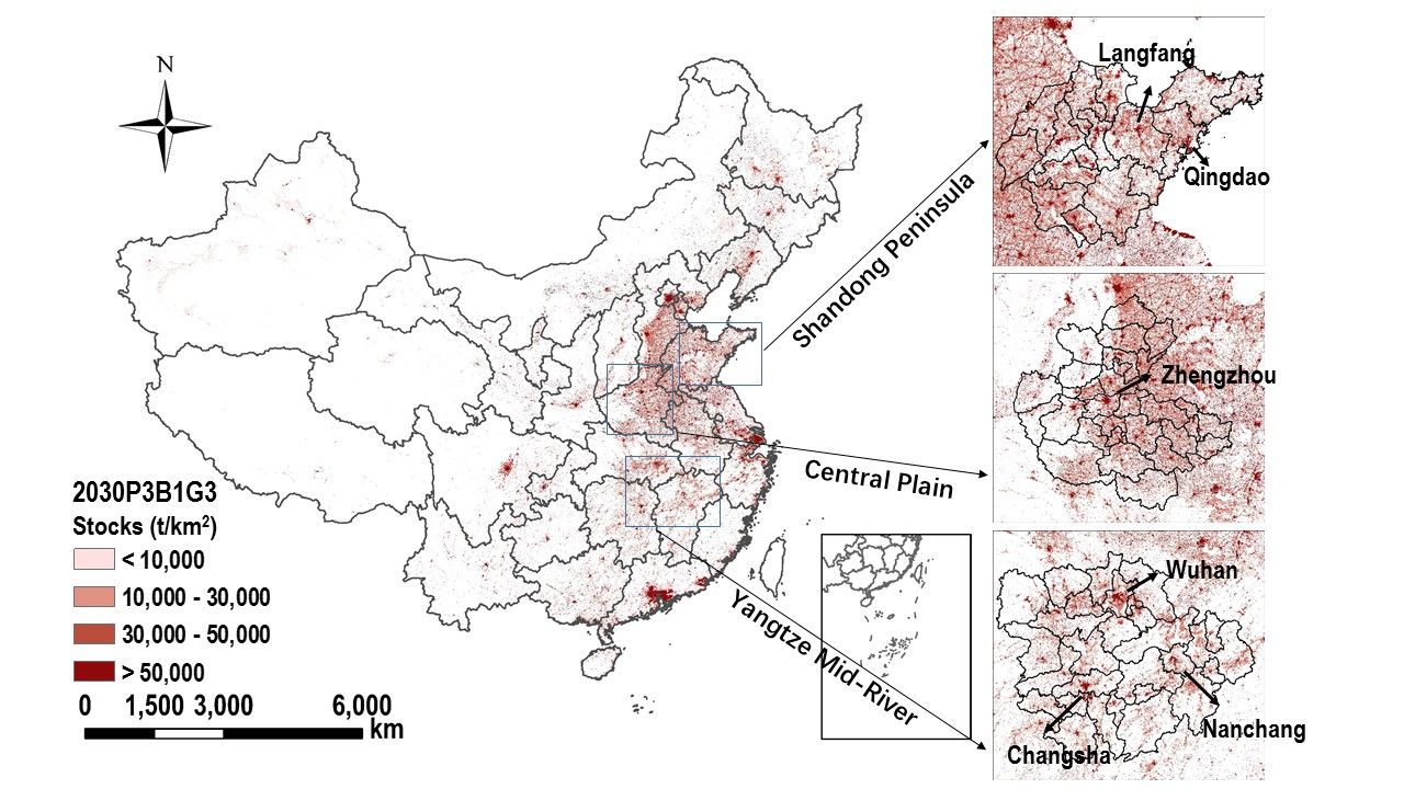
High-resolution mapping of steel resources accumulated above ground (referred to as steel stocks) is critical for exploring urban mining and circular economy opportunities. Prior studies have attempted to approximate steel stocks using nighttime light (NTL). Although it serves as a fast estimation technique, the accuracy of the NTL-based approach may be subject to several limitations and it has not been able to provide future projections. To fill these gaps, we developed an aggregative downscaling model that fuses multiple large-scale spatial datasets, including gridded population, gross domestic product, and built-up area. We demonstrated the utility of this model by using it to map steel stocks in mainland China at a 1×1 km resolution. Our results found the steel stocks increased from 12,873 t/km2 to 33,027 t/km2 during 1995-2015, and four steel stocks clusters (i.e., Beijing-Tianjin-Hebei agglomeration, Yangtze River Delta, Guangdong-Hong Kong-Macao Greater Bay Area, and Chengdu-Chongqing metropolitan) possessed over 40% of the national total in 2015, revealing an unbalanced distributed pattern of steel stocks across China. Moving forward, steel accumulation will mount to 64,636 t/km2 and accelerate in larger cities in 2030, such as Beijing, Shanghai, Shenzhen, and Guangzhou. Our analysis highlights the magnitude and pace at which steel resources have been and will be accumulated above ground. Our estimates capture the spatiotemporal dynamics of steel stocks, potentially allowing better policy-making and business decision-making on resource efficiency, waste management, and environmental sustainability on regional or urban scales.
Gridded mapping of in-use steel stocks in 2030.